Quen Santo
Huehuetenango, Guatemala – 2006 - 2007
Quen Santo, located in the western highlands of Guatemala, is an important site because of the investigations by the famous German archaeologist Eduard Seler between 1895 – 1897. Seler studied three caves that contained an intact structure, architecture, and monumental sculptures. The structure and architecture were still well preserved when the site was visited by Sergio Garza in 2005 so a CSULA project was launched the following year. The project relocated and remapped Seler’s three caves and located a number of additional caves. One of the new caverns contained a masonry tomb, only the second cave with such a feature in the entire Maya region. In addition, the CSULA project discovered a large quantity of modifications that allowed the archaeologists to reinterpret the site.
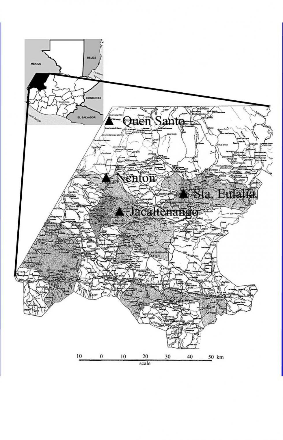
Figure 1: Map of the Department of Huehuetenango, showing the location of the principal sites investigated.
An ethnoarchaeological study that was regional in scope was a significant component of the project. Quen Santo was studied as an important modern pilgrimage center for the Chuj Maya and an interesting Holy Week ritual was recorded from the nearby town of Nentón. Ethnographic work was also carried out at a cave near the town of Jacaltenango, a Jakaltek Maya speaking community that is well known to anthropology from the book, The Year Bearer’s People. Finally, significant new data were collected about an important cave known as Yalan Na’ in the Q’anjob’al Maya speaking community of Santa Eulalia. Tantalizing clues about the central role of the cave in the village’s religious life had been provided in Oliver LaFarge’s book, Santa Eulalia: The Religion of a Chuhumatán Indian Town, but our work provided far more detail and context.
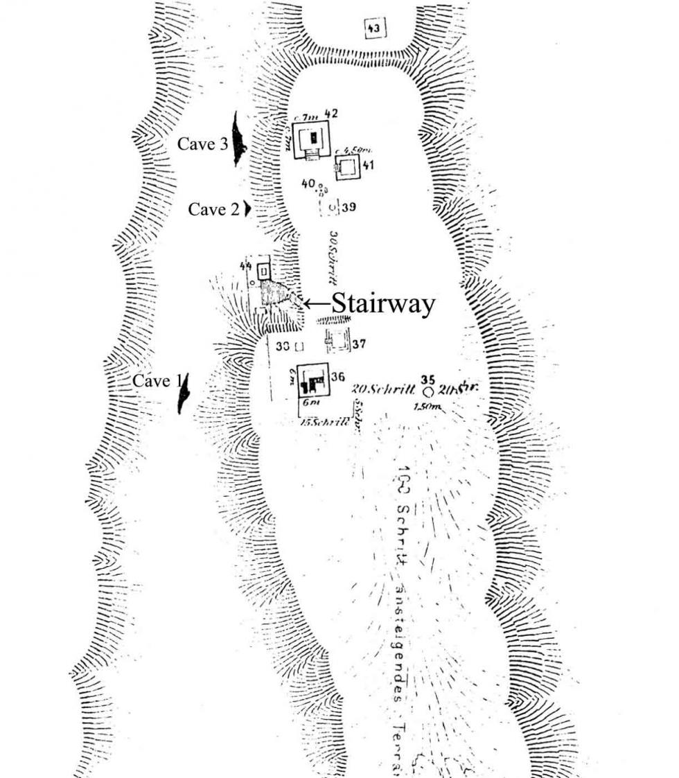
Figure 2: Seler’s map of Quen Santo showing the location of Cave 1 and its relationship to site architecture.
|
|
|
|
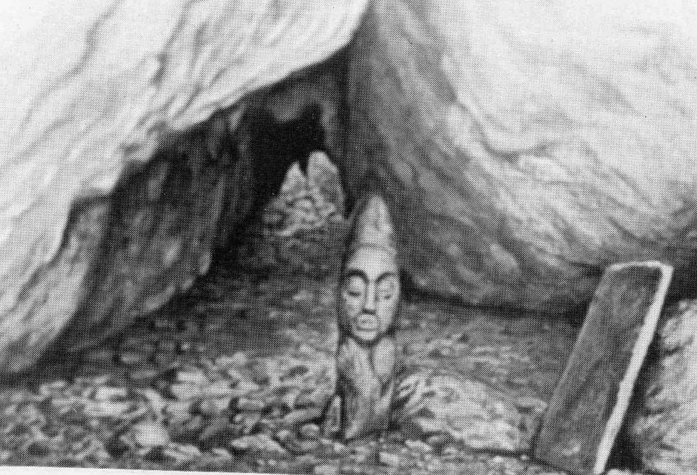
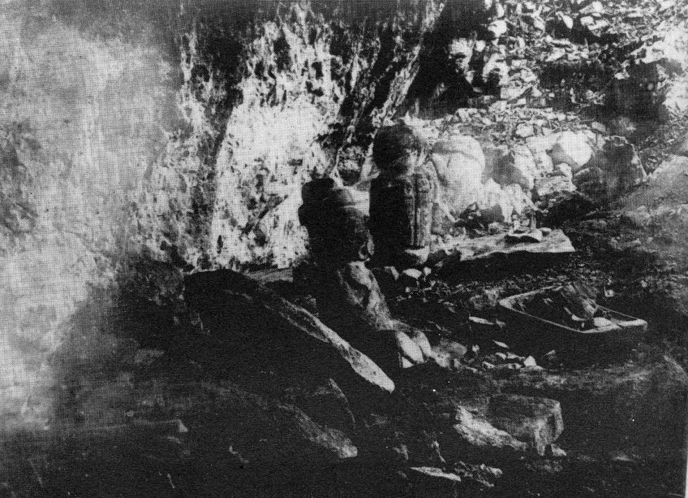
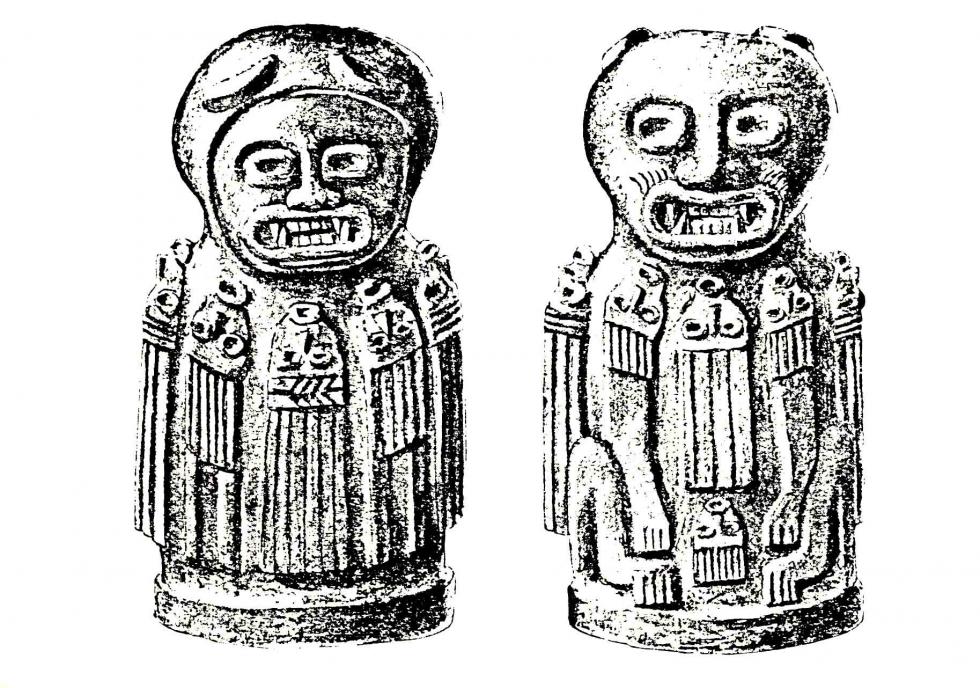
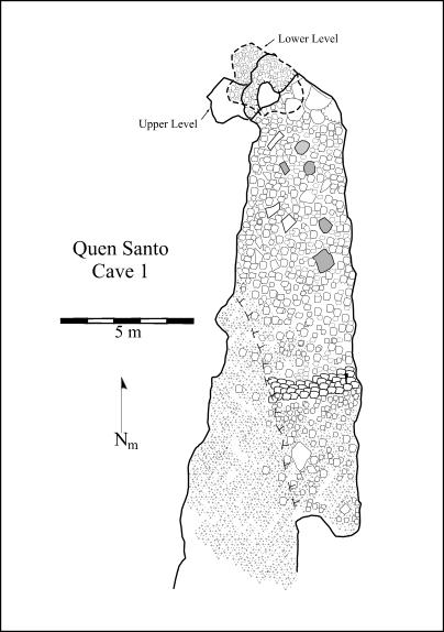
Figure 3: a) A number of sculptures were still present in Cave 1 when Seler took this photograph. | b) Seler’s drawing of one of the sculptures illustrates the different faces on each side. | c) Allan Cobb’s map of Cave 1. | d) Cave 1 as it looks today. |
Two of the students who worked on the project went on to Ph.D. programs, Jennifer Mercede to U.C. Santa Barbara and Crystal Kieffer to the University of New Mexico. Finally, the project published a monograph, Exploring Highland Maya Ritual Cave Use, that featured a number articles co-authored by students.
|
| ||
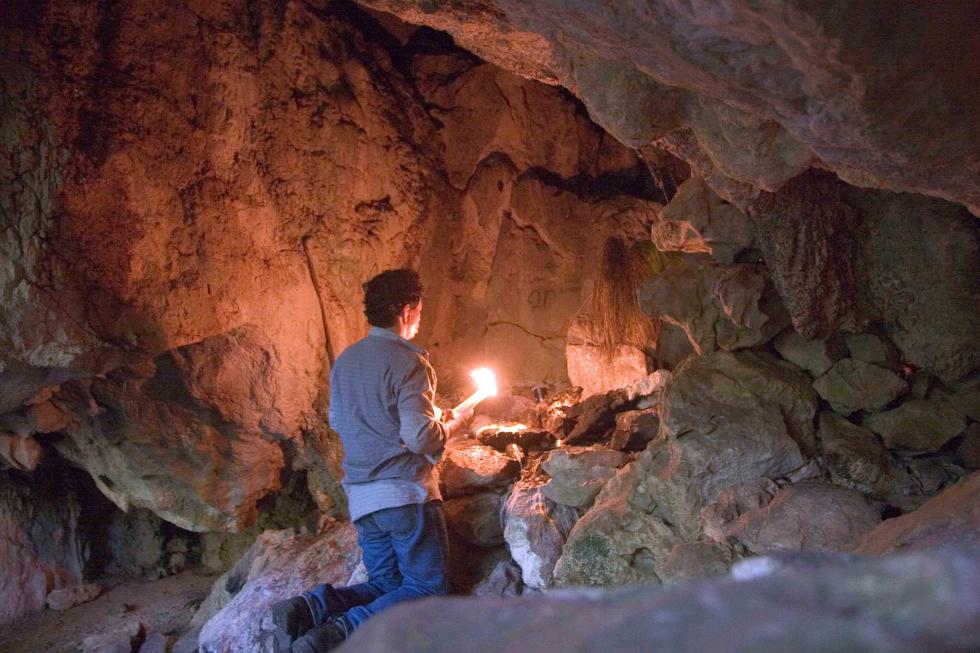
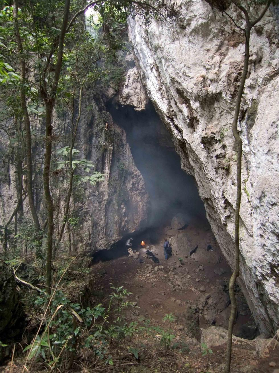
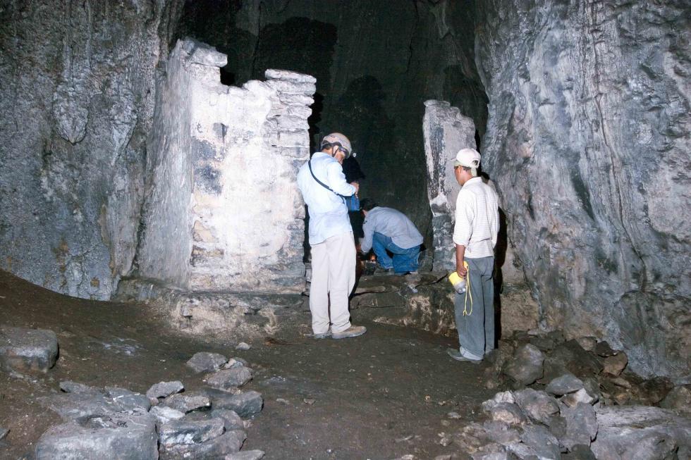
Figure 4: a) Cave 2 is a small cave at the Southern end of the chasm that run below the site. | b) Our Jakaltec prayer leader conducting the ritual that started work each day at the site. | ||
|
|
| |
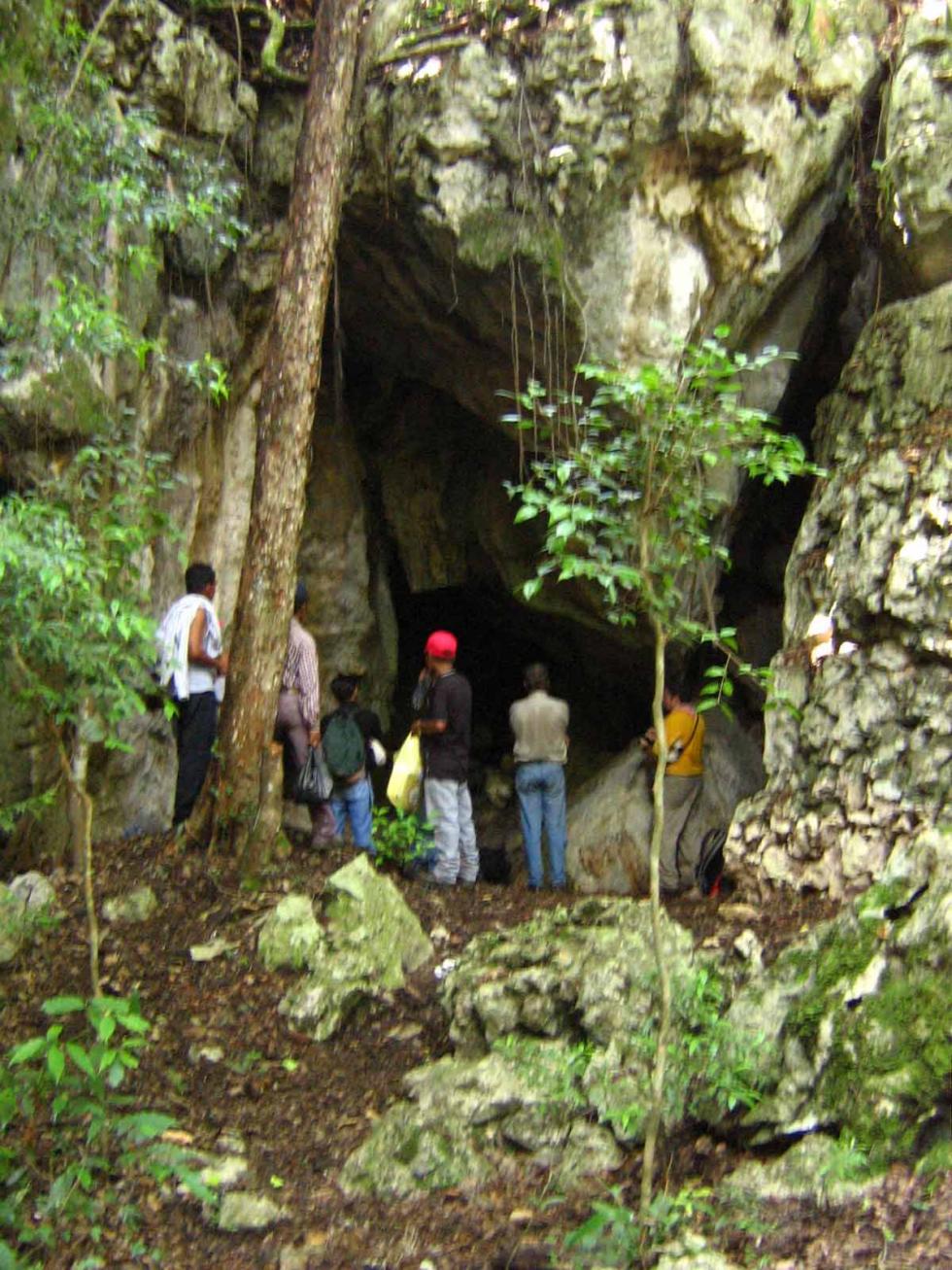
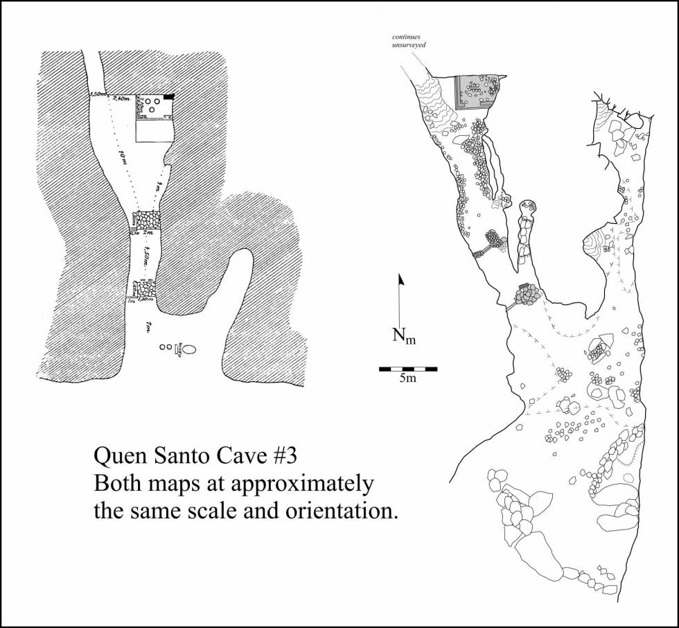
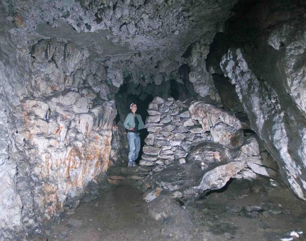
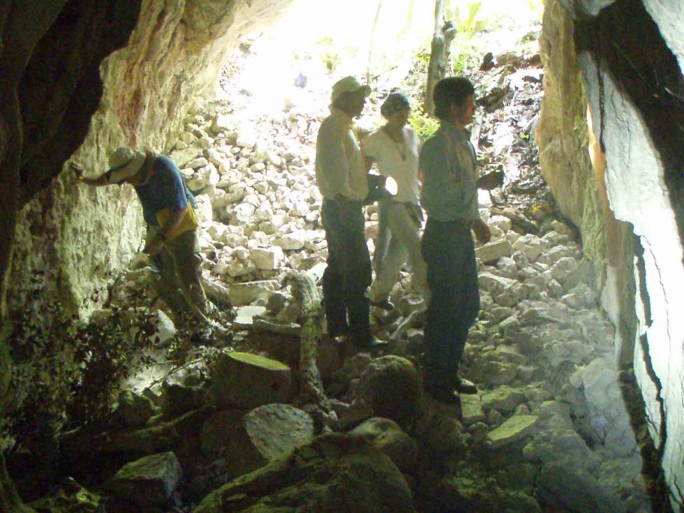
Figure 5: a) The entrance to Cave 3 today. | b) Seler’s drawing of the entrance to Cave 3 in the 1890s with sculptures in place. | c) Seler’s map and Allan Cobb’s map of Cave 3. | |
|
| ||
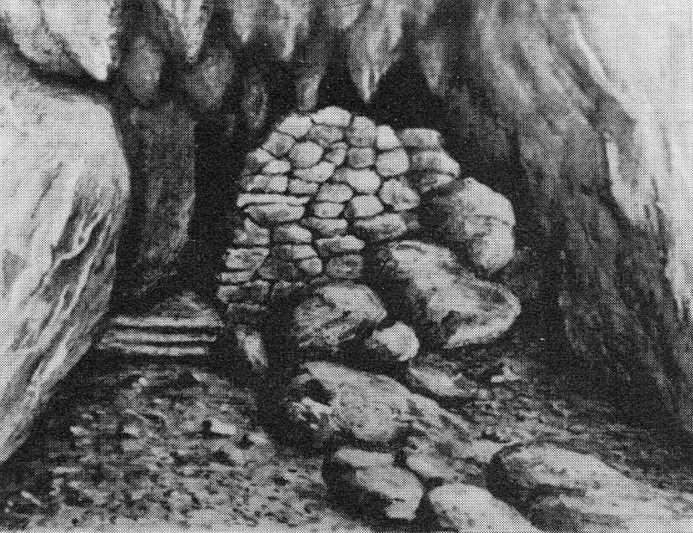
Figure 6: a) Seler’s drawing of the inner wall in Cave 3 | b) the same wall as it looks today. | ||
|
|
|
|
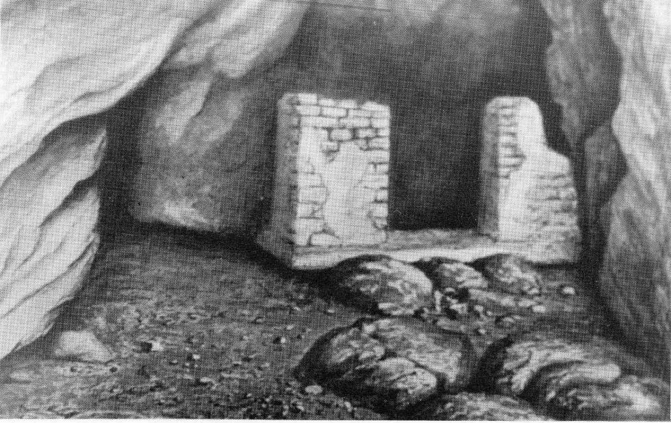
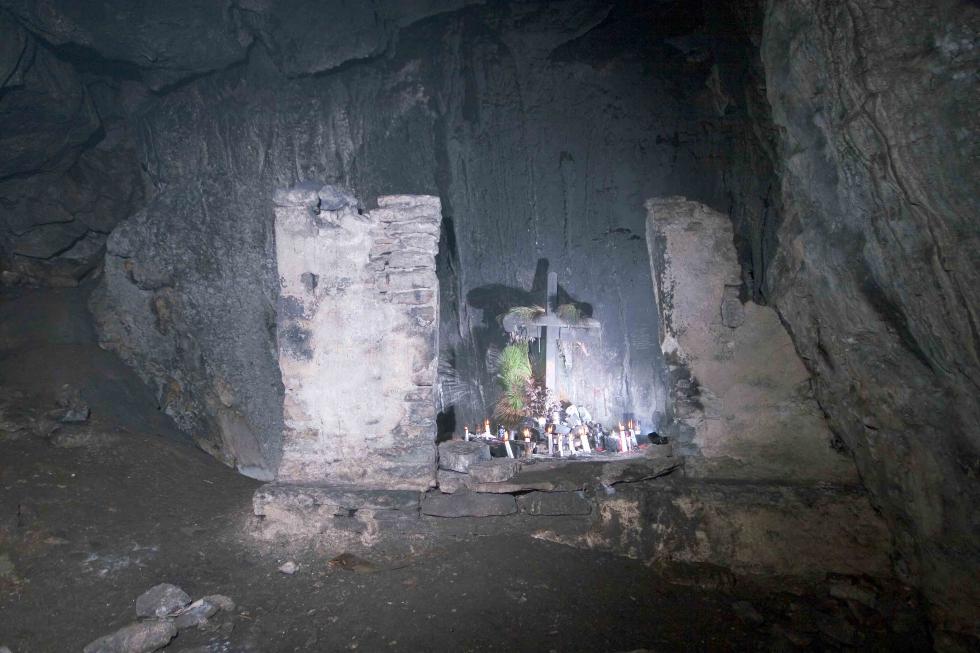
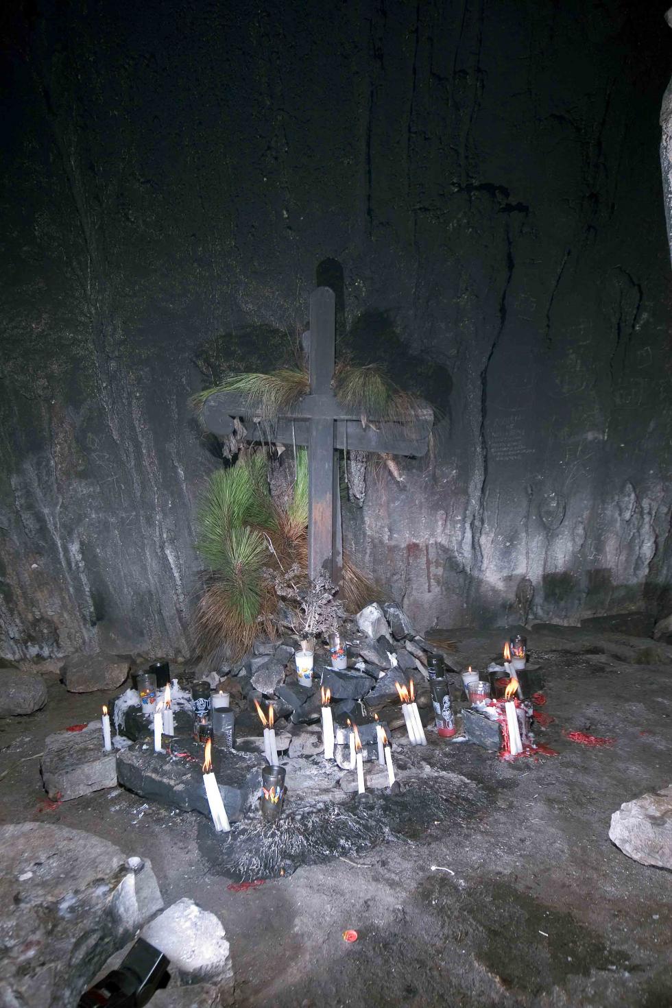
Figure 7: a) Seler’s drawing of the structure that he calls the “temple room.” | b) & c) The structure as it looks today. | d) A cross with a pine needle garland now occupies the center of the structure where Pre-Columbian figures and incense burners had been in Seler’s time. |